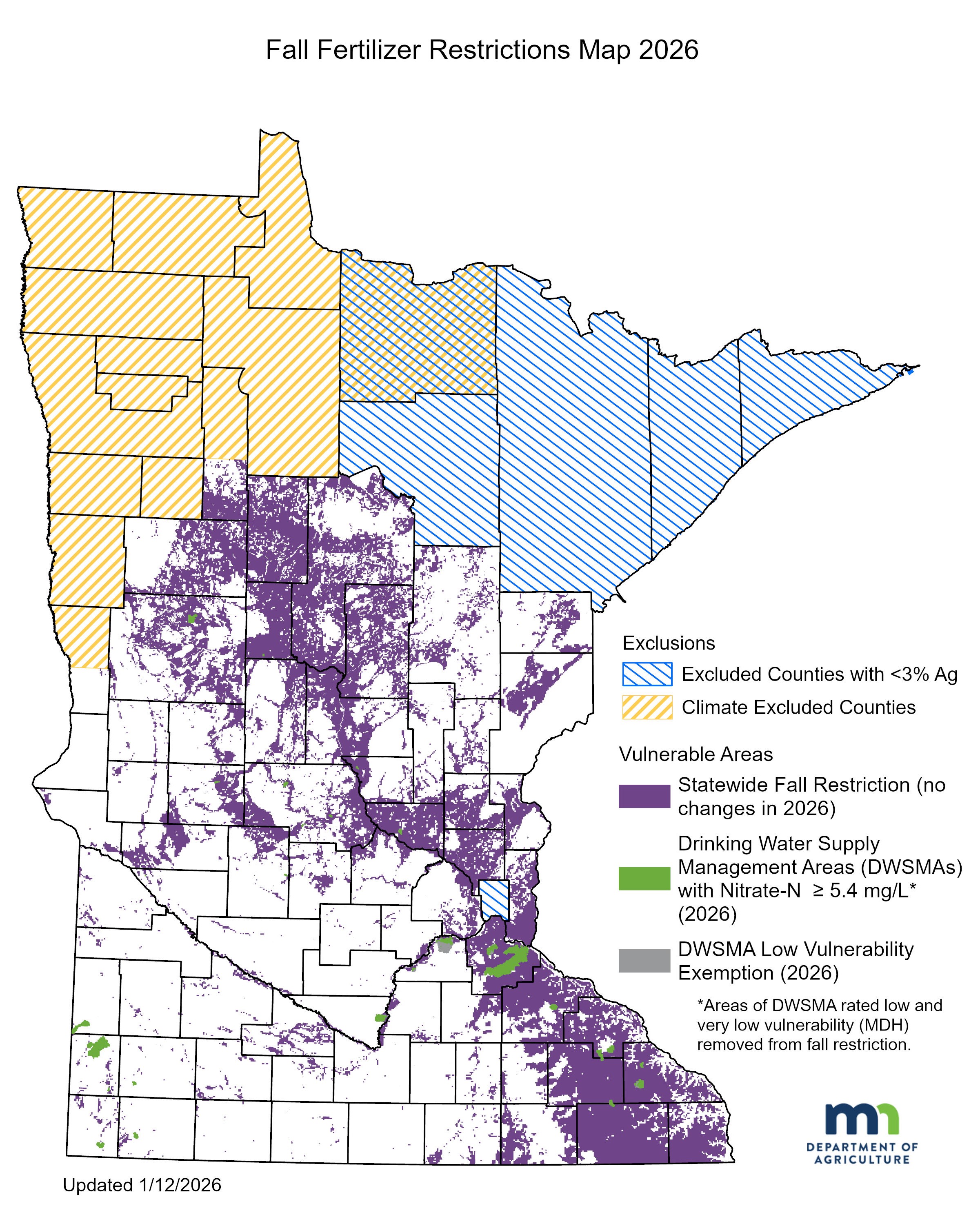
View the interactive Vulnerable Groundwater Area Map
The application of nitrogen fertilizer on cropland in the fall or on frozen soils will be restricted in vulnerable groundwater areas. This includes quarter-sections of land where 50 percent or more of the quarter-section is in an area with vulnerable groundwater and in DWSMAs that have nitrate-nitrogen concentrations at or in excess of 5.4 mg/L nitrate-nitrogen.
An area with vulnerable groundwater is an area where nitrate can move easily through soil and into groundwater, contaminating drinking water sources. Some portions of the DWSMAs have low and very low vulnerability, those areas are not subject to the fall restriction. Vulnerable areas for Part 1 of the rule are defined as:
- coarse textured soils based on USDA NRCS soils maps
- shallow bedrock based on USDA NRCS soils maps; or
- karst geology based on MN DNR map.
Areas within a DWSMA which are low risk to groundwater contamination in the Minnesota Department of Health Wellhead Protection Plan are exempt from fall application restrictions.
To access all of the mapping layers select the layer list icon in the upper left corner of the map page. To view a layer, check the box to the left of the layer title. Note that some adjustments were made to the Drinking Water Supply Management Area layers in January 2025.
The map shapefiles can be downloaded from the Minnesota Geospatial Commons
View the interactive Vulnerable Groundwater Area Map


